Kootenay Connect: Climate Change Science
As climate disruption continues and intensifies, understanding future predictions will improve our preparedness and landscape resiliency.
Climate Change Science Highlights
The highlights from Year 1 (2019-20) to Year 7 (2025-26) are listed below.
Year 7 Highlights (2025-26)
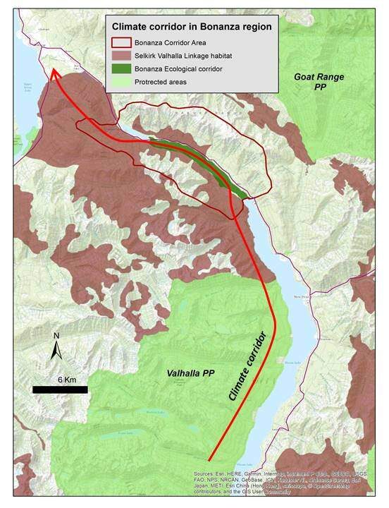
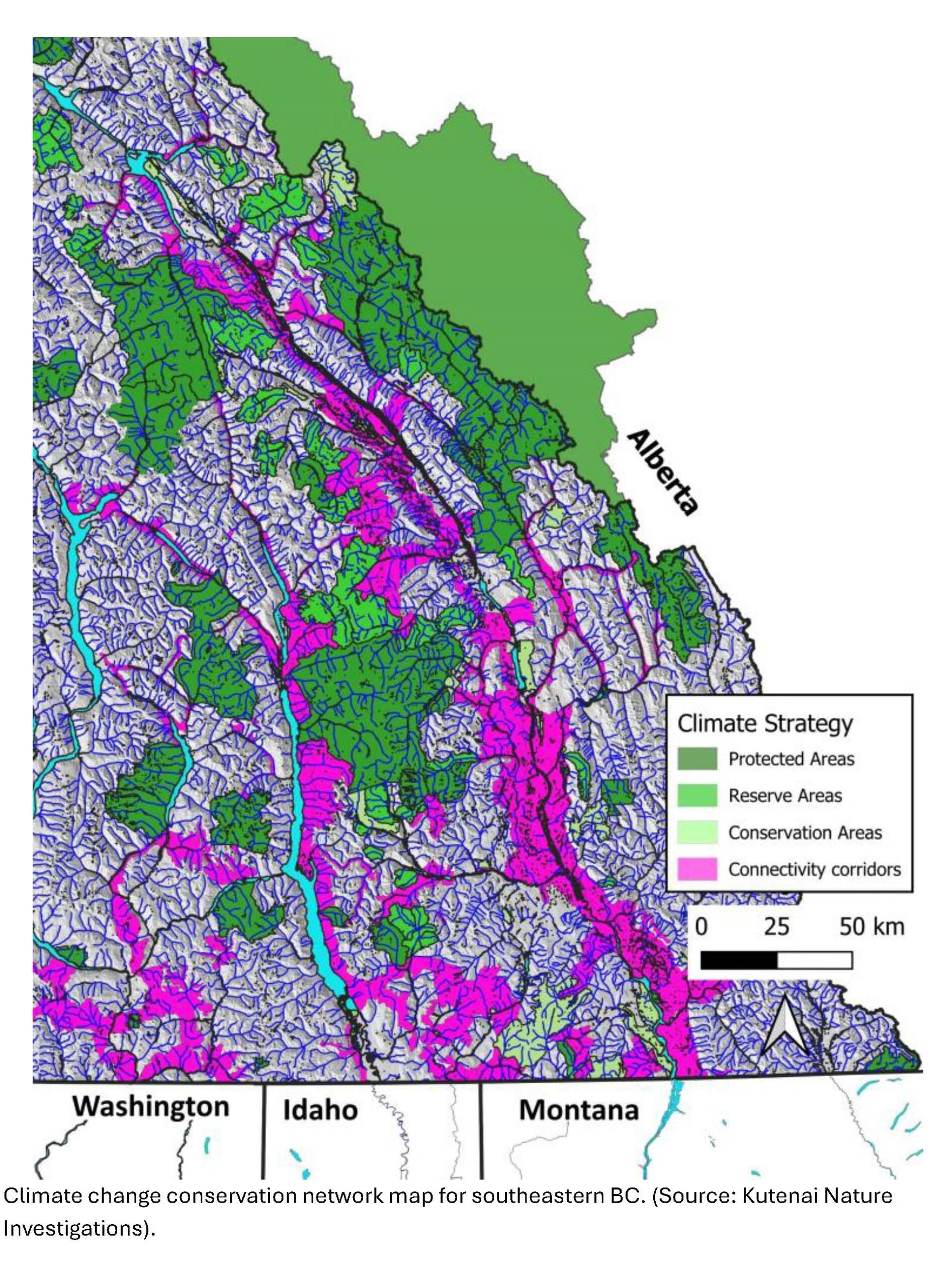
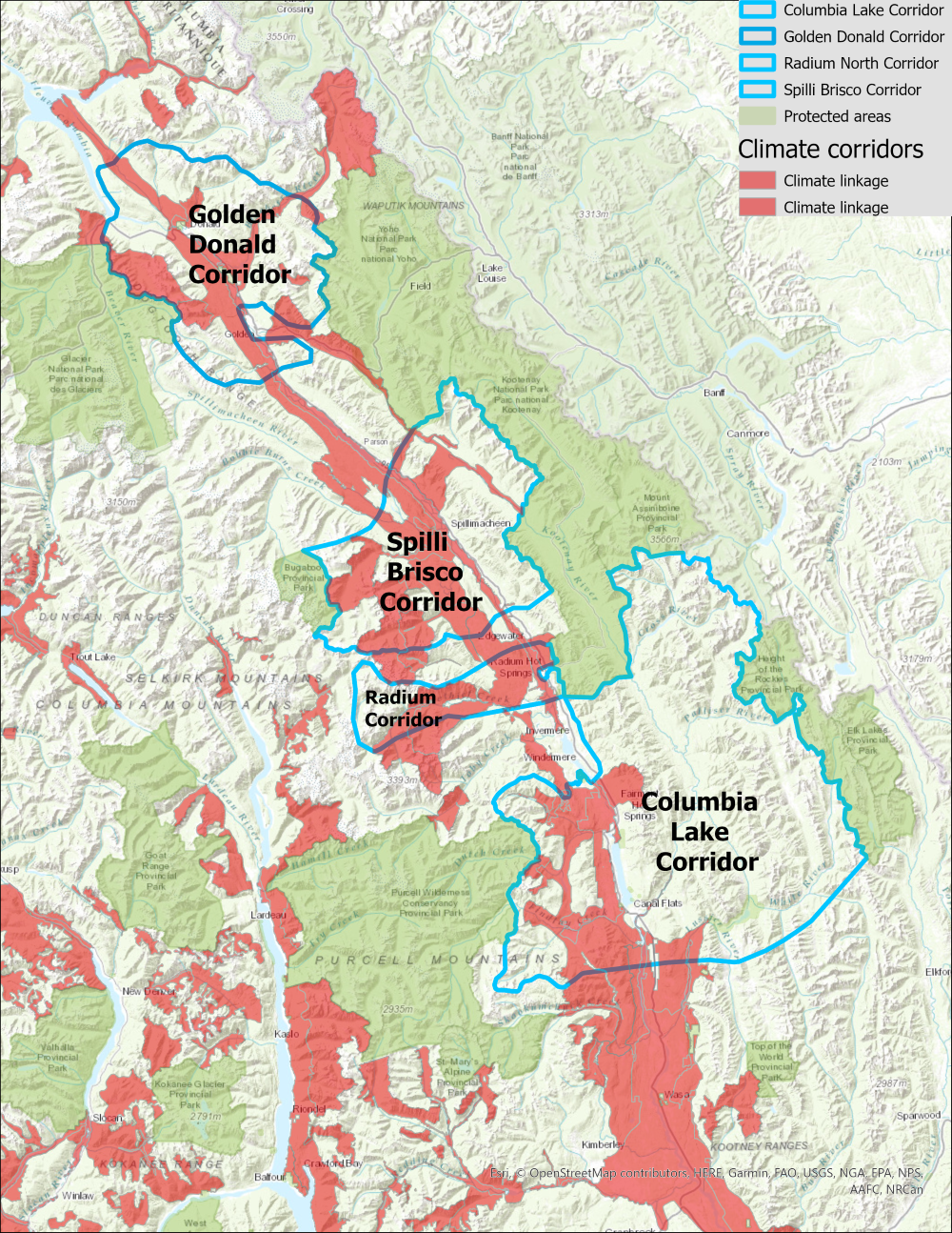
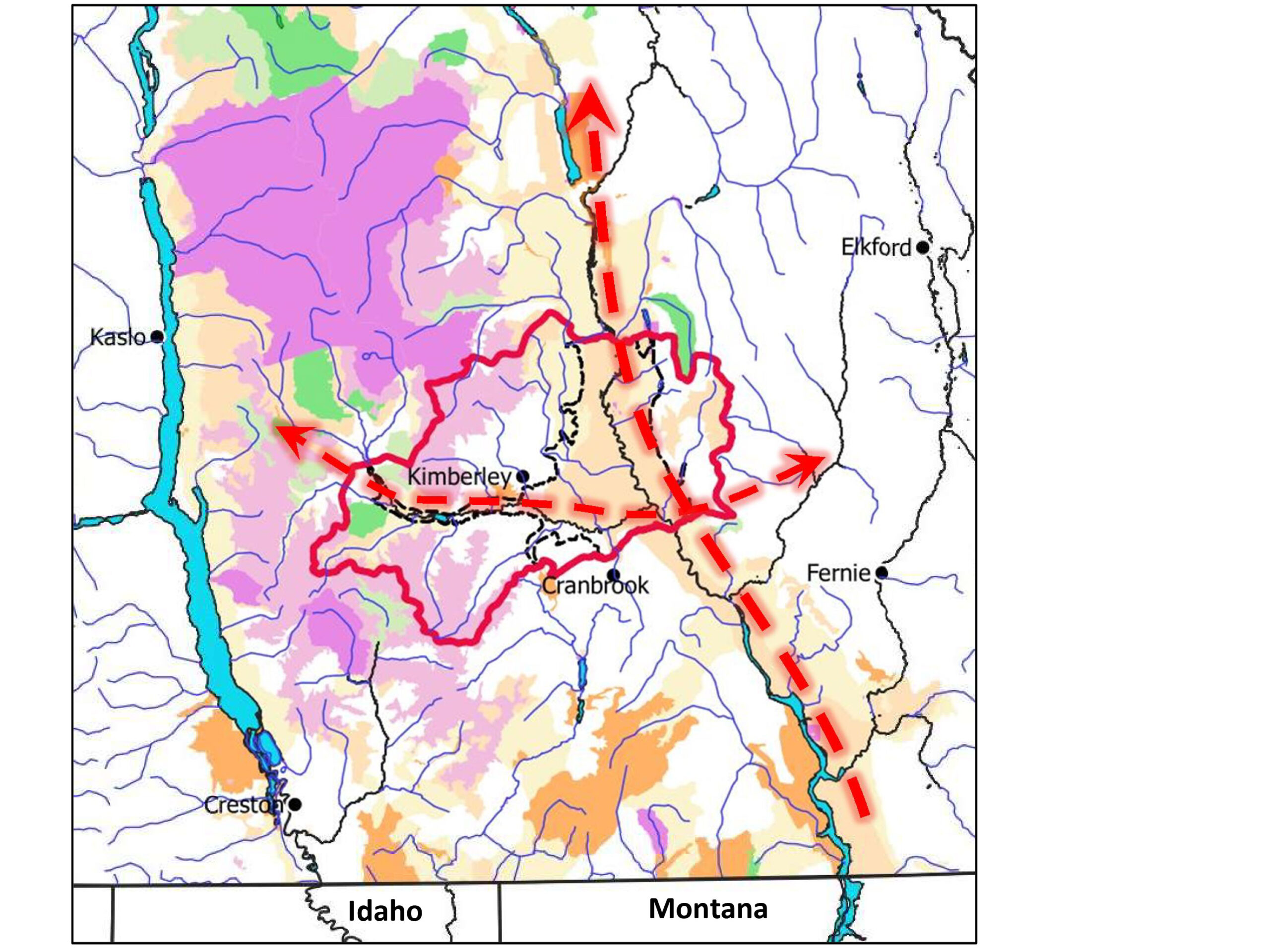
The Climate Change Conservation Network mapping originated from a process to design regional conservation plans resilient to climate change for the East Kootenay. The initial areas were identified as part of the Forest Stewardship Council Certification (FSC) of forest management in that area, and included public advisory teams from Fernie to Golden. The climate change analysis and resulting conservation map emphasizes areas identified for connectivity to enhance opportunities for ecosystems and species to shift ranges in response to climate change, and should be considered a “work-in-progress”.
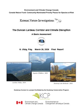
The Duncan Lardeau Coridor includes the watersheds draining into the North end of Kootenay Lake, the Lardeau River, and the Duncan River and Duncan Reservoir south of Hall Creek. For the climate change analysis, the assessment area encompasses an area defined by watershed boundaries that slightly enlarges the Duncan Lardeau Corridor to coincide with topographic features that are associated with important climatic variables. As climate disruption continues and intensifies, warming temperatures and changes in precipitation patterns are projected to have profound impacts on the habitats of the corridor over the coming decades. The potential for increasing drought and a more frequent fire regime may result in shifts from continuous closed forest to open mixed forest, savanna, or even grassland/steppe ecosystems in the valley bottoms. Decreasing snowpacks and increasing wildfire activity will increase the importance of riparian habitats for connectivity within the corridor. This assessment has therefore focused on factors that may affect wildfire activity, hydrologic regimes of the major creeks and rivers, and associated riparian ecosystems.
Year 6 Highlights (2024-25)
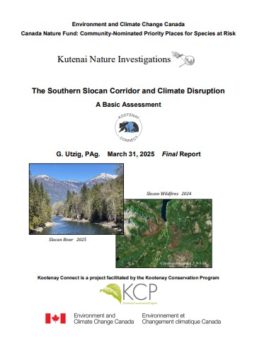
As climate disruption continues and intensifies (IPCC 2021), warming temperatures and changes in precipitation patterns are projected to have profound impacts on the habitats of the corridor over the coming decades. The potential for increasing drought, shifts from savanna and mixed forest to grassland/steppe ecosystems in the valley bottoms, decreasing snowpacks and increasing wildfire activity will increase the importance of riparian habitats for connectivity within the corridor. This assessment has therefore focused on the lower elevations of the Trench and the Rocky Mountains, increasing wildfire activity, and the potential for changes in the flows of the major river systems.
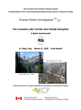
As climate disruption continues and intensifies (IPCC 2021), warming temperatures and changes in precipitation patterns are projected to have profound impacts on the habitats of the corridor over the coming decades. The potential for increasing drought and more frequent fire regime may result in shifts from continuous closed forest to open mixed forest, savanna, or even grassland/steppe ecosystems in the valley bottoms. Decreasing snowpacks and increasing wildfire activity will increase the importance of riparian habitats for connectivity within the corridor. This assessment has therefore focused on the lower elevations of the main valley, increasing wildfire activity, and the potential for changes in the flows of the major river systems.
Year 3 Highlights (2021-22)
The Columbia Wetlands occur in the Rocky Mountain Trench along the upper reaches of the Columbia River between Columbia Lake and the Kinbasket Reservoir in British Columbia. The Columbia Wetlands are a hot spot for biodiversity and climate resilience, and efforts are being made by the Columbia Wetlands Stewardship Partners and others to identify potential climate impacts and on-the-ground actions. The purpose of this report is to summarize the potential impacts of climate change on surface water inputs to the wetlands, and ecosystems surrounding the wetlands.
As climate disruption continues (IPCC 2021), warming temperatures and changes in precipitation patterns are projected to have profound impacts on the habitats of the Wycliffe Corridor over the coming decades. The potential increasing drought and shifts from savanna and mixed forest to grassland/steppe ecosystems in the valley bottom will likely increase the importance of riparian habitats for connectivity within the corridor. This assessment has therefore focused on two aspects of the corridor: the lowest elevations in the valley bottom of the Trench, and the potential for change in the flows of the St. Mary River.
Year 1 Highlights (2019-20)

This report was prepared to outline a potential approach to incorporating changes associated with climate disruption into threat assessments and management planning for Kootenay Connect wildlife linkage areas. The report focuses on the Creston Valley and the Bonanza Biodiversity Corridor (BBC) areas as examples.