The highlights from Year 2 (2020-21) to Year 7 (2025-2026) are listed below.
Year 7 Highlights (2025-26)
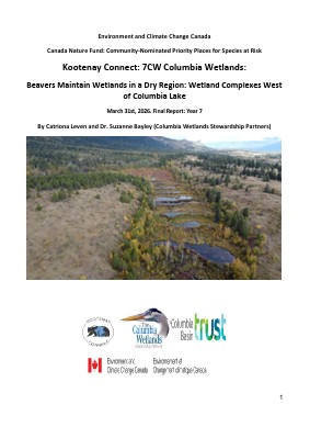
In previous work, the Columbia Wetlands Stewardship Partners (CWSP) found that the upland bench west of Lake Windermere and Columbia Lake has a greater moisture deficit than the upland benchlands further north, resulting in a higher potential for wetlands that are vulnerable to climate change. In 2025, CWSP returned to finish surveys of beaver dams/lodges in the Upper Marion Creek West Wetlands. Given the lack of permanently inundated wetlands in this area, these wetlands and the beaver dams that maintain them are particularly important in providing wetland habitat and water on the landscape. In 2025 CWSP also surveyed the beaver dams and lodges in the wetland complex approximately 1.5 km north-east of the Upper Marion Creek West Wetlands complex, and confirmed local knowledge that these wetlands are drying.
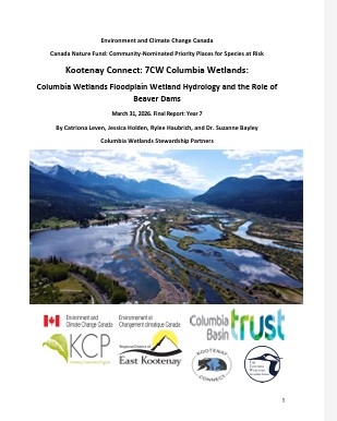
The Columbia Wetlands Stewardship Partners (CWSP) have been monitoring the water levels, vegetation, waterbirds and water quality of the Columbia Wetlands – little knowledge was available on the hydrology and ecology prior to the Kootenay Connect project. They found that individual floodplain wetlands can be categorized hydrologically based on their connection to the flood pulse of the Columbia River as Most, Partially, and Least Connected. Across the whole ~18,000 ha Columbia Wetlands floodplain, 74% of wetlands are in the Most Connected group, while only 26% are Partially or Least Connected wetlands. This means that most of the wetlands drain out over the winter when the water levels of the Columbia River fall. Beaver dams are important for retaining water in the wetlands over winter and early spring before the spring melt in May and June, and in 20222, CWSP began looking at using Beaver Dam Analogues (BDAs) as a restoration technique to restore selected wetlands, where natural beaver dams had blown out or been removed by humans, in order to increase the amount of Partially Connected wetlands within the floodplain.
In the western benchlands of the upper Columbia Valley, the Columbia Wetlands Stewardship Partners (CWSP) have used a combination of in-person fieldwork, drone photography, and modeling to study the wetlands, lakes, and streams since 2023. These observations have allowed CWSP to better understand the status of these wetlands, threats facing them, and to identify wetlands that they can restore using beaver dam analogues (BDAs). In 2025, CWSP continued effectiveness monitoring, identified additional potential restoration sites, and built 21 BDAs and 7 Post Assisted Log Structures (PALs) across four wetland sites, with more planned for 2026. In 2025 they also validated the 2023 drone wetness classification by visiting 38 wetlands that had been assessed with drone photographs, and assessed the sites based on wetland vegetation, disturbance, landscape location, and water source. They also groundtruthed the Wetland Restoration Feasibility Index by visiting 52 wetland sites included in the analysis, and recoded water source, water quality, vegetation, wetland position on the landscape, and signs of drying.
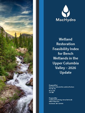
As little is known about the hydrology of the wetlands in the Upper Columbia River Valley, prioritization of wetland restoration is a challenge, but is an important first step. The Columbia Wetlands Stewardship Partners (CWSP) have developed a simple restoration feasibility index to help score wetlands based on their likelihood of long-term restoration success, using publicly available data to develop an approach that can be adapted for other areas. Geospatial analyses were used to calculate watershed-scale measures from digital elevation models (DEMs). Additionally, measures for how dry a region might be, taken from climate data to simulate precipitation minus evapotranspiration (P-ET) were used. In total a flow accumulation index, a wetness index and a P-ET index were combined to provide the restoration feasibility index, which ranks wetlands as having low, moderate, high, or very high potential to be successfully restored. The index was verified against field data during the summer of 2025 and was updated to improve its predictive powers.
Snow accumulation and melt play an important role in shaping the Columbia River and the Columbia Wetlands, which are dependent on spring snowmelt to create a freshwater pulse that overtops levees and refills the wetlands. Wetland recharge from groundwater is also driven by snowmelt. Monitoring data from the Columbia Wetlands were used in this study investigated the relationship between snow water equivalent (the amount of water in the snowpack) and average wetland water level over the period from 2020 to 2025. The Columbia Wetlands Stewardship Partners (CWSP) found that maximum winter snow water equivalent was significantly related to average wetland water levels, with a very strong relationship. Snow water equivalent predicted average water levels even better than maximum annual streamflow, suggesting seasonal snowpack is critical for providing source water to the Columbia Wetlands.
Year 6 Highlights (2024-25)

Report: Characterizing the Vulnerability of the Columbia River Floodplain Wetlands to Climate Change
This study examines the vulnerability of the Columbia Wetlands to climate change based on their location using a combination of field investigation and hydrological modelling, with special attention paid to select wetlands that have either experienced or have planned restoration efforts to improve water retention. We found there is regional variation in wetland vulnerability, where the northern portion of the study is likely to be less affected by shifts in climate due to an increase in water supply and less atmospheric sensitivity. The southern portion of the study area is highly vulnerable, with an earlier onset of spring freshet accompanied by an insignificant increase in peak streamflow and substantial water loss under a warmer climate. All wetland groups are likely to be equally vulnerable; however, water retention will be critical to maintain wetland diversity. The Beaver Dam Analogues are an important adaptation measure, particularly in the southern portion of the study area. Without these structures, it is likely that water levels would continue to follow the patterns of the Columbia River. A longer streamflow recession period with hotter and drier summer conditions could lead to a substantial reduction in open water area, already being observed in other studies.
In 2024, CWSP continued to study the hydrology and ecology of the Columbia River floodplain wetlands. We monitored water levels and water quality in 37 wetlands and conducted migratory bird surveys in 20 wetlands. This is the fifth year we have monitored water levels, and the fourth year we have surveyed migratory birds, allowing us to draw conclusions from multiple years of data. We have also continued to apply for permits to be able to build Beaver Dam Analogues to restore deeper water levels to certain wetlands and increase habitat diversity.
In 2023, CWSP surveyed 371 sites by drone on the western benchlands of the Columbia Valley and with in-person site assessments determined that nine were suitable for potential restoration using Beaver Dam Analogues (BDAs). In 2024, we continued this work and further assessed 30 wetlands in-person and determined two more are suitable for potential restoration using BDAs. In October 2024 we built four BDAs at two sites, S-Land and Beaver Channels. We created wetlands or restored wetlands in the dry upland benchland of Columbia Valley. At the S-Land Site our efforts produced 12,793 m2 of flooded area, 3399 m3 of stored water, and 1.17 ha freshwater atlas wetland polygon. At the Beaver Chanels site our efforts produced 39,700 m2 of flooded area, 8969 m3 of stored water, 12.49 ha freshwater atlas wetland polygon. We anticipate that the restorations completed at S-Land and Beaver Channels stored 12,368 m3 of water flooded over 52,493 m2 of land within these wetlands.
In this study, MacDonald Hydrology Consultants Ltd. develop a quantitative restoration feasibility index to help score wetlands based on their likelihood of long-term restoration success. We use publicly available data to develop an approach that can be modified for other areas. As wetlands within the benchlands of the Columbia Valley have been shown to be highly dependent on reliable water sources, the type of water source contributing to a wetland is the first contributing score, where intermittent streams are the lowest ranked, and larger streams are ranked higher. Measures of the contributing area and slope, which create a wetness index, are taken from a digital elevation model (DEM). And finally, measures for how dry a region might be, taken from climate data to simulate precipitation minus evapotranspiration (PET) were used. All these combined to provide the restoration feasibility index, which ranks wetlands as having low, moderate, high, or very high potential to be successfully restored. Of the 443 bench wetlands examined, 168 wetlands were found to have a low wetland restoration feasibility index, 153 had a moderate wetland restoration feasibility index, 74 had a high wetland restoration feasibility index, and 48 had a very high wetland restoration feasibility index.
Year 5 Highlights (2023-24)
This video summarizes the work done by the Columbia Wetlands Stewardship Partners (CWSP) through Kootenay Connect to document and monitor the wetlands in the western uplands of the Columbia Valley, and restore and enhance some of these wetlands. This includes plans to restore 39 hectares of wetlands by utilizing beaver dam analogues.

Within the Upper Columbia Wetland, an area known for its undammed and relatively natural floodplain wetlands, there is a series of wetlands colloquially known as the Bench Wetlands that exist along a benched hillside in the upland area on the west side of the Columbia Valley along the base of the Purcell Mountains. These wetlands have faced numerous stressors, such as forestry, ranching, development, and many appear to have dried up, particularly in the more southern extent. While these wetlands may be smaller than the floodplain wetlands in the valley bottom, these small wetlands are still extremely important, as smaller wetland ecosystems can provide an ecological network known as a wetlandscape, which can include both connected (either to a stream or a lake) and disconnected wetlands (i.e. those that do not appear to have any surface water connections). In the current study, we examine the Bench Wetlands in the Columbia Valley to assess their vulnerability to climate change and determine what drivers might be important in affecting their vulnerability. This study will be used to guide future monitoring, modelling, and restoration efforts.

The Columbia Wetlands are a series of floodplain wetlands within the Upper Columbia River Basin in Canada which exist in the only undammed portion of the river system. As these wetlands are largely influenced by the seasonal flood pulses that occur around June and are driven by snowmelt and rainfall, these wetlands may be greatly impacted by the potential impacts of climate change. Over the past several decades several hydroclimatic changes have occurred, including increased air temperatures, precipitation shifts, and changes in flow timing, duration, and magnitude. In the current study we examine the vulnerability of the Columbia Valley floodplain wetlands to climate change by examining a) the impacts of climate change on the Columbia River, and b) the effects of climate change on areas within the wetlands without the influence of the river. This allows us to interpret the effects of seasonal changes in environmental factors and better understand which wetlands are more at risk of change under future climate conditions.

Beavers may provide some natural mitigation of the effects of climate change on the Columbia Wetlands by increasing wetland resilience and complexity, and specifically by increasing open water area. Most of the research undertaken on beavers has not been in a floodplain system the size of the Columbia Wetlands, where the river is large and undammed and the floodplain is up to 2 km across. Beavers in the Columbia Wetlands are not damming the Columbia River itself, they are damming small side channels and wetlands within the floodplain, and the impacts of this type of dam-building activity are very different from the impacts of dam-building activity in incised streams or even in river floodplains of around 500 m in width. Crucially, while in an incised stream system water flow is unidirectional, only flowing over the beaver dams one way, in a floodplain system the water flows over beaver dams in both directions. In the spring, as the flood pulse rises, water flows over the beaver dams from the Columbia River into the wetlands; once the flood pulse has receded, the water flows out of the wetlands (either over, through, or under the dams, if they are present) into the Columbia River. Thus, the influences of beaver dams on the morphology, hydrology, and vegetative characteristics of these wetlands are likely profound, and as yet not well understood.
The western upland bench of the Columbia Valley provides a suitable landscape for many small wetland features where minimal investigative work has been completed. The Freshwater Atlas of BC, an open-source database that maps provincial freshwater attributes, identifies 349 lake and 479 wetland polygons on the bench between Canal Flats and Spillimacheen. In 2023, we visited 371 of the 828 (45%) mapped polygons either via drone or in person to generate a summary of wetland status and identify potential restoration sites. Our project goal is to restore 5 – 10 hectares of wetlands on the upland bench of the Columbia Valley using Beaver Dam Analogues – in 2023, we identified 22 potential sites that are suitable for restoration with this method. We focused on collecting detailed information for permit applications and effectiveness monitoring at nine of these sites, which would allow us to flood 13 ha within the FWA mapped boundaries. These measurements include stream flow and water quality, the size of the remnant beaver dam gap needing repair, estimated flood area, bathymetry, vegetation community mapping, vegetation plots, and orthomosaic drone imagery. In early 2024, we submitted permit applications for two of these sites.
This report focuses on the use of environmental DNA (eDNA) metabarcoding to investigate climate change vulnerability of wetlands and restoration effectiveness. The eDNA method allows estimation of species richness from collected benthic samples without the need for traditional microscopic taxonomic identification. We are using eDNA metabarcoding method to quantify the genetic composition and the biodiversity of vulnerable wetlands and assess the effects of restoration activities in the context of an adaptive-management framework. eDNA monitoring includes analysis of samples for macroinvertebrates, fish, and diatom genomic sequences to evaluate use of these taxa as a component of wetland effectiveness monitoring. In addition, to the genomics work we are monitoring other key ecosystem attributes including hydrology, SARA-listed species, migratory birds and vegetation and mapping.
Year 4 Highlights (2022-23)

This project combines hydrological and ecological assessments to better understand the Columbia Wetland Complex and the individual wetlands within it. It includes a hydrological classification of the different wetland types observed within the Columbia Wetlands and the ecological consequences of their differences. We assessed the vulnerability of the wetlands to climate change and the potential for beaver dam analogues (BDAs) to be used as a low-tech and relatively natural restoration technique. We restored (and repaired) one 54 ha wetland with several beaver dams and gathered the data and support needed to acquire a permit for another 22 ha wetland. We provided The Nature Trust of BC and Environment & Climate Change Canada, who own and manage a parcel of the Columbia National Wildlife Management Area, with the data and guidance to install and repair beaver dams in site 71 to raise the water levels for spring migrating birds.
Year 3 Highlights (2021-22)

MacDonald Hydrology Consultants (MacHydro) in collaboration with the Columbia Wetland Stewardship Partners (CWSP) conducted a project to evaluate wetland vulnerability and determine priority wetlands where management actions like conservation or mitigation should be implemented. The objectives of the hydrology subproject included: monitoring wetland water levels in 38 wetlands, characterizing the wetlands into types based on geomorphic and hydrometric data, constructing conceptual wetland water balances, evaluating how hydrometeorological conditions and wetland water levels may change under future simulated climate change projections, and describing the wetland vulnerability to climate change based on the conceptual understanding of predominant water sources and fluxes to inform future mitigation actions.
Year 2 Highlights (2020-21)

This is an ambitious project to identify and map the flood basins in the Columbia Wetlands that are vulnerable to drought and climate change and to determine if and where the loss of water can be mitigated by local conservation actions. The three subprojects include (1) A remote sensing observation-based assessment of floodplain hydroperiod and wetland vulnerability analysis of 2600 ha of wetlands to determine if remote sensing can determine if the area of permanent open water has changed in the last 20 year compared to earlier years; (2) Upper Columbia Wetland Vulnerability Assessment Project is an analysis to hydrologically characterize the different types of wetlands and determine which wetlands are most vulnerable to drought and loss of water overwinter and (3) Importance of Ground Water to the Hydrologic Mass Balance of Columbia Wetlands provides an assessment of the importance of ground water to the wetlands during spring, summer and fall seasons. Together these projects will enable the hydrologic team to develop hydrologic budgets of the different types of wetlands and determine those wetlands most vulnerable to drought.

Recent hydroclimatic change has impacted flows and floodplain inundation patterns on the Upper Columbia River, BC, Canada, leading to a reduction in open water wetland areas. The over-arching objective was to develop and report on the data, methods and results of a proof-of-concept study to identify wetlands at risk by evaluating wetland hydroperiod change in the Upper Columbia River Floodplain.
The goal of the Upper Columbia Wetland Vulnerability Assessment project is to determine the various types of wetlands in the upper Columbia Wetlands based on their hydrologic functions, determine which types of wetlands are more vulnerable to drought (and climate change), and to assess which wetlands may be amenable to conservation actions to prevent the loss of water. This work is classifying the wetlands based on their hydrologic and morphological characteristics. In May 2020, the team installed continuous water level loggers in 37 wetlands, 2 in the Columbia River, and 4 drive point piezometers to monitor shallow groundwater input in 4 sites. Precipitation and evaporation are also available from local data. Together, these data will be used to construct water balances of the monitored wetlands for extrapolation across all wetland types in the upper Columbia.
